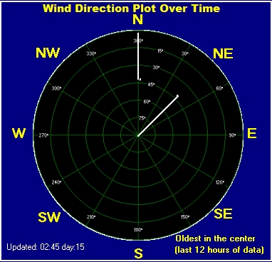
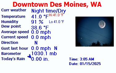
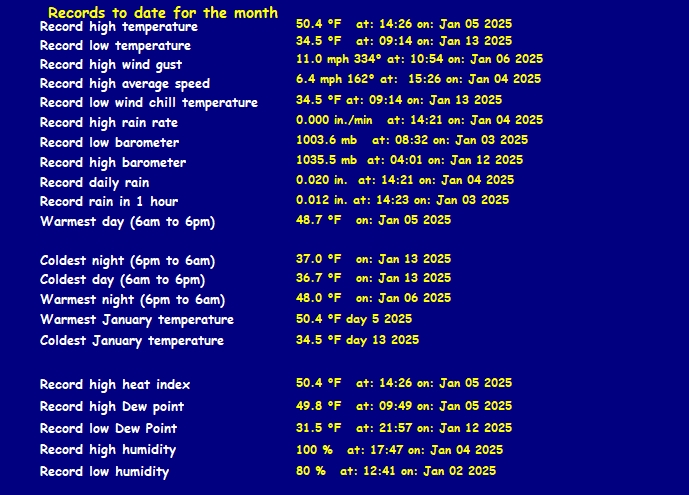
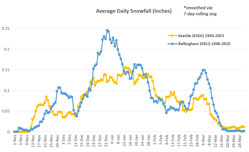
A series of wet weather systems moving across the region will
increase the threat of river flooding early this week.
* WHAT...Flooding caused by excessive rainfall continues to be
possible.
* WHERE...Portions of northwest and west central Washington,
including the following counties, in northwest Washington,
Clallam, Grays Harbor, Island, Jefferson, Kitsap, Mason, San Juan,
Skagit and Whatcom. In west central Washington, King, Lewis,
Pierce, Snohomish and Thurston.
* WHEN...From late tonight through Friday afternoon.
* IMPACTS...Excessive runoff may result in flooding of rivers,
creeks, streams, and other low-lying and flood-prone locations.
Flooding may occur in poor drainage and urban areas.
* ADDITIONAL DETAILS...
- An atmospheric river moving into the region early this week
will bring periods moderate to heavy rain to the region.
Sharp rises will be possible on area rivers, especially those
flowing off the Olympics and Cascades.
Urban and small stream flooding is possible for areas with
poor drainage.
Saturated soils will bring increased potential for landslides
and debris flows on burn scars.
- Http://www.weather.gov/safety/flood
Average daily snowfall plot using 1945-2024 surface weather datasets from the TD3505 NOAA database for SeaTac airport (KSEA) and Bellingham Airport (KBLI).